 |
| Sanliurfa |
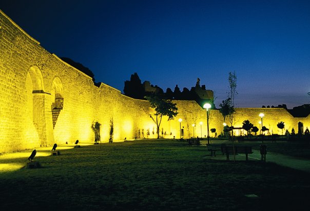
The origins of Sanliurfa are very old considering that the place is known as the “City of the Prophetes” because it would have welcome Abraham, Job, Jethro and St George. Its location in Upper Mesopotamia, at the point of confluence between different civilizations, explains a rich and eventful past. The city, named “Hurri” (which means caves) by the Babylonians, maintained good relationships with the Mitanians, the Hittites and the Egyptians. Named “Osrhoe” by the Greeks and “Orhai” by its Aramean population, the Macedonians of Alexander the Great finally called it “Edesse”. It came under the sovereignty of the Seleucids, of Armenia at the time of Tigrane, of the Parthians, the Romans, the Sassanids and the Arabs. The city was christianized around 200, and it remained Byzantine until it fell into the hands of the Seljuks and later the Crusaders. From 1098 and during fifty years the earldom of Edesse with Beaudoin of Boulogne (Godefroy of Bouillon's brother) plaid an important role in the fight of the Frankish states against Islam. Taken back by the Seljuks and the Mamelukes, the city was united very late in 1637 to the Ottoman Empire.
Source : guide-martine
 |
| Sanliurfa |
 |
| Sanliurfa |
 |
| Sanliurfa |
 |
| Sanliurfa |
 |
| Sanliurfa |
 |
| Sanliurfa |
 |
| Sanliurfa |
 |
| Sanliurfa |
 |
| Sanliurfa |
 |
| Sanliurfa |
 |
| Sanliurfa |
 |
| Sanliurfa |
 |
| Diyarbakir |
Diyarbakir rises above the right bank of the Tigris River (Dicle) to the north of the Mesopotamian plain. Many thousands of years ago, the volcano Karacadag, now extinct, erupted leaving a thick layer of basalt. Diyarbakir, which has its foundations on this black basalt stratum, is known as “the Dark” because the walls and much of the old town are constructed from the rock.
The region of Diyarbakir saw a succession of civilizations such as the Hurrites, Mittanians, Arameans, Chaldeans, Assyrians, Urartians, Medes, Persians, Macedonians. The city, known at the time under the name Amida, from 115 AD, was at stake in the wars between the Romans and the Parthians and later the Sassanids. Finally in 297 AD, Amida was annexed to the Roman Empire. A fortress was built on the hillock overlooking the city and in 349, Emperor Constance surrounded it by walls that later were reinforced by the Byzantines and particularly in the 6th century under the reign of Justinian, to face the continuous Sassanid threat. But aroud 638, the tremendous walls could not resist the attacks of the Arab tribes regrouped unter the banner of Islam and who had set out to capture Syria, Mesopotamia and Iran, after defeating the Byzantines on the banks of the Yarmouk River (which delimits the modern border between Jordan and Syria) in 636.
Source : guide-martine
.jpg "Diyarbakir") |
| Diyarbakir |
 |
| Diyarbakir |
 |
| Diyarbakir |
.jpg "Diyarbakir") |
| Diyarbakir |
.jpg "Diyarbakir") |
| Diyarbakir |
.jpg "Diyarbakir") |
| Diyarbakir |
.jpg "Diyarbakir") |
| Diyarbakir |
.jpg "Diyarbakir") |
| Diyarbakir |
 |
| Diyarbakir |
 |
| Diyarbakir |
 |
| Diyarbakir |
 |
| Diyarbakir |
 |
| Diyarbakir |
 |
| Diyarbakir |


